
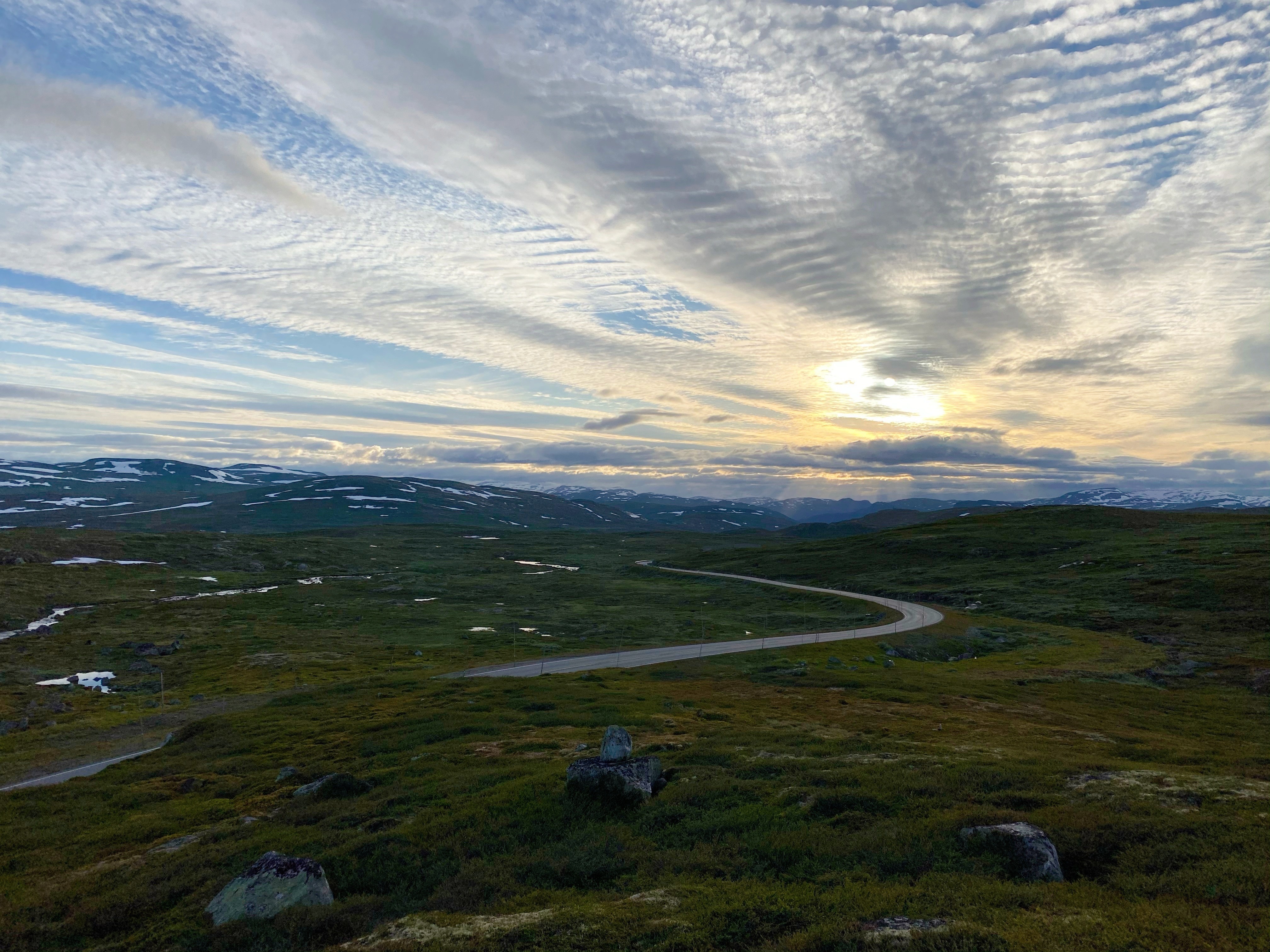
As we were en route to the Vestland trip. Our first stop was Vøringsfossen, one of the most-visited waterfalls. Since we took the motorhome, we took our time on the trip and chose to drive through Hardengervidda, the national scenic route in Norway. Honestly, the road was really beautiful and I recommend it.
Once you arrived, there is a proper, spacious parking lot, together with a lovely cafe and a public toilet. The waterfall is just within the 500-m walk and the walkway is well constructed along the edge of the cliff. Now the new bridge across Vøringsfoss is officially open to using…even better!
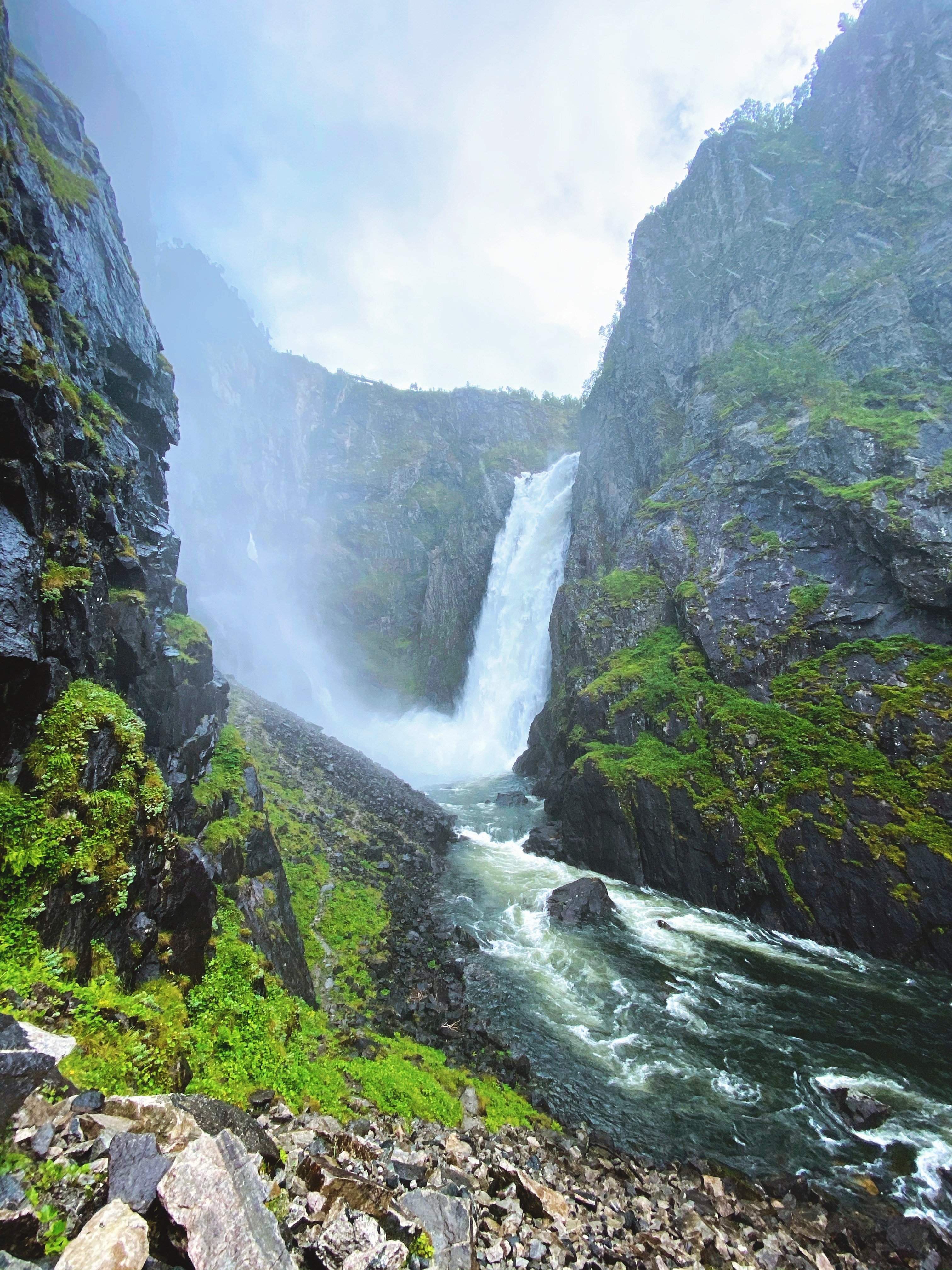
The Vøringsfoss waterfall is ranked as one of the highest waterfalls in Europe. Though you might have seen pictures or videos prior to your visit, I guarantee you that the waterfall can still impress you! If you have time, I would recommend the hike down to the bottom of the waterfall. There, you will be able to properly feel the power of the waterfall.


The hike to the bottom of vøringsfossen
According to Fjord Norway, the trail takes 2-3 hours and is considered as ‘rough terrain’. For us, especially in August, it was not that rough, but, yes, it was slippery from place to place. (Saying from my personal experience, I slipped and hit my knee to a rock and could still manage to get down and back up within 2 hours.)

- A good pair of hiking shoes is recommended (though I saw people got away with just jogging shoes.)
- Prepare a rain jacket, waterproof or extra clothes. The power from the water falling 182m to the ground is so tremendous that it creates an extremely moisty environment at the bottom of the waterfall. Let’s say, you will be properly wet.
- Bring some necessary snack, food and drink. (We enjoyed ourselves with a nice cup of coffee and cheese sandwich after the hike.)
Where to park for the Vøringsfoss hike?
Fjord Norway suggests that, “Parking at Fossatromma / Vøringfoss Cafeteria, about 17 km from the centre of Eidfjord along route 7. Alternative parking (if available space) about 2 km before Fossatromma at Storegjel, at the upper end of the Måbø tunnel.”
As the parking at Vøringfoss Cafeteria will make your walk even longer, people mostly choose the parking at the upper end of the Måbø tunnel. Let me make it easy for you, here’s the link to Google Map. The street view will show you the parking located right before the tunnel. Just make sure that you do not obstruct any car that driving to/from the tunnel.
Be aware that the ‘Parking for Vøringsfossen Hike’ on Google Map IS WRONG! We drove there. There is no parking space, but a small road, which Google Map suggested we drive into. The road forbids all types of vehicles.

According to the World Waterfall Database, 10 of the 30 tallest waterfalls in the world are in Norway. Read more about it at Visit Norway.